By Kailyn Corrigan
As a non-engineer/scientist, there is a lot of unfamiliar language I’ve come across since my introduction to the A/E/C industry in May 2014. For example, there is an entire division at Pare Corporation dedicated to geotechnical engineering – a term I’d never heard before I visited the company website. In order to be a successful marketing contributor, I try to notice which words come across my desk or within office earshot most often, and I ask a lot of questions. In 2015, I began to notice the term “GIS” more and more often, and so I realized it was time for me to investigate what GIS means and why its mention is on the rise.
In December 2014, Pare hired Sarah Pierce, a recent graduate of Westfield State, to join our Environmental Science group. In June of this year, Sarah was promoted to a full-time GIS Specialist and Environmental Scientist, so I asked her if she wouldn’t mind giving me a quick tutorial—a “GIS for Dummies,” if you will.
Wikipedia weighs in
Before meeting with Sarah, I made sure to check what GIS stood for, seeing as that was my first question, and nowadays one is expected to “Wikipedia” the basics. I learned GIS stands for “Geographic Information System.” Well that was a relief! At least I was familiar with the three words that comprise the acronym. I’m not always so lucky. I perused the resources Sarah provided me before the interview to develop a basic understanding, and I noticed that GIS is not exclusive to the A/E/C industry. Excited to share something in common with GIS already, I prepared my questions.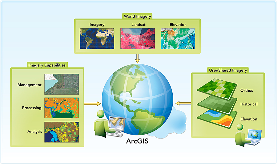
I sat with Sarah, and asked for the less technical explanation of how GIS is used in our industry. Sarah explained that “GIS allows you to view data as a geographic representation.” For example, before GIS, location and project data was entered and viewed in list form, using software such as Microsoft Excel, and then data was applied to a map in a two-part process. GIS has made it a one-step process, which Sarah credited as one of GIS’s biggest benefits, “GIS has cut fieldwork time in half.”
A Growing Technology
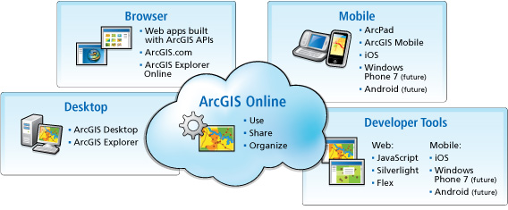
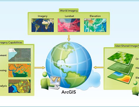
Now that I understood a little bit more about what GIS actually accomplishes, I was interested in learning why it is a growing technology. According to my Googling, GIS has been around since the 1960’s. GIS consists of an electronic display map, where the information you upload is associated with the corresponding geographic coordinates. When I asked how the growth spurt in GIS usage started, Sarah showed me the computer tablet she uses. While GIS has always been a helpful tool, prior to the development of portable computer tablets, GIS was restricted to desktop computers…which obviously aren’t as compatible with working in the field. The tablet has enabled engineers and scientists to enter and review data, whether they are in the office or knee deep in swamp land. Software companies like Esri have increased the mobility of GIS and the reasons for using it through tablet apps, such as Collector, which syncs information with ArcMap Online, the GIS software used on desktops.
Moving Forward
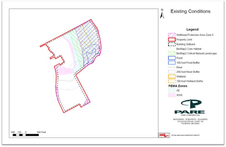
A Pare project illustrating the visual components of data mapping.
I asked Sarah about Pare’s specific GIS expansion and which projects have benefitted the most from GIS technology. Currently it is used most often in feasibility studies, setback (a term commonly used in floodplain management) maps, and asset management in hydraulic modeling. However, Sarah hopes to utilize even more opportunities, and has developed a plan to do so. Sarah will be holding Lunch & Learns open to all staff. By providing the newest developments in GIS information and resources to staff members, our engineers will find new ways to integrate GIS into their projects. When I asked for an example of an area where GIS isn’t being used but should be, Sarah mentioned that it can be used as an alternative to computer aided drafting (CAD) in some cases. She hopes that Lunch and Learns will spark ideas among staff members and ultimately alleviate the workload of our very busy CAD department.
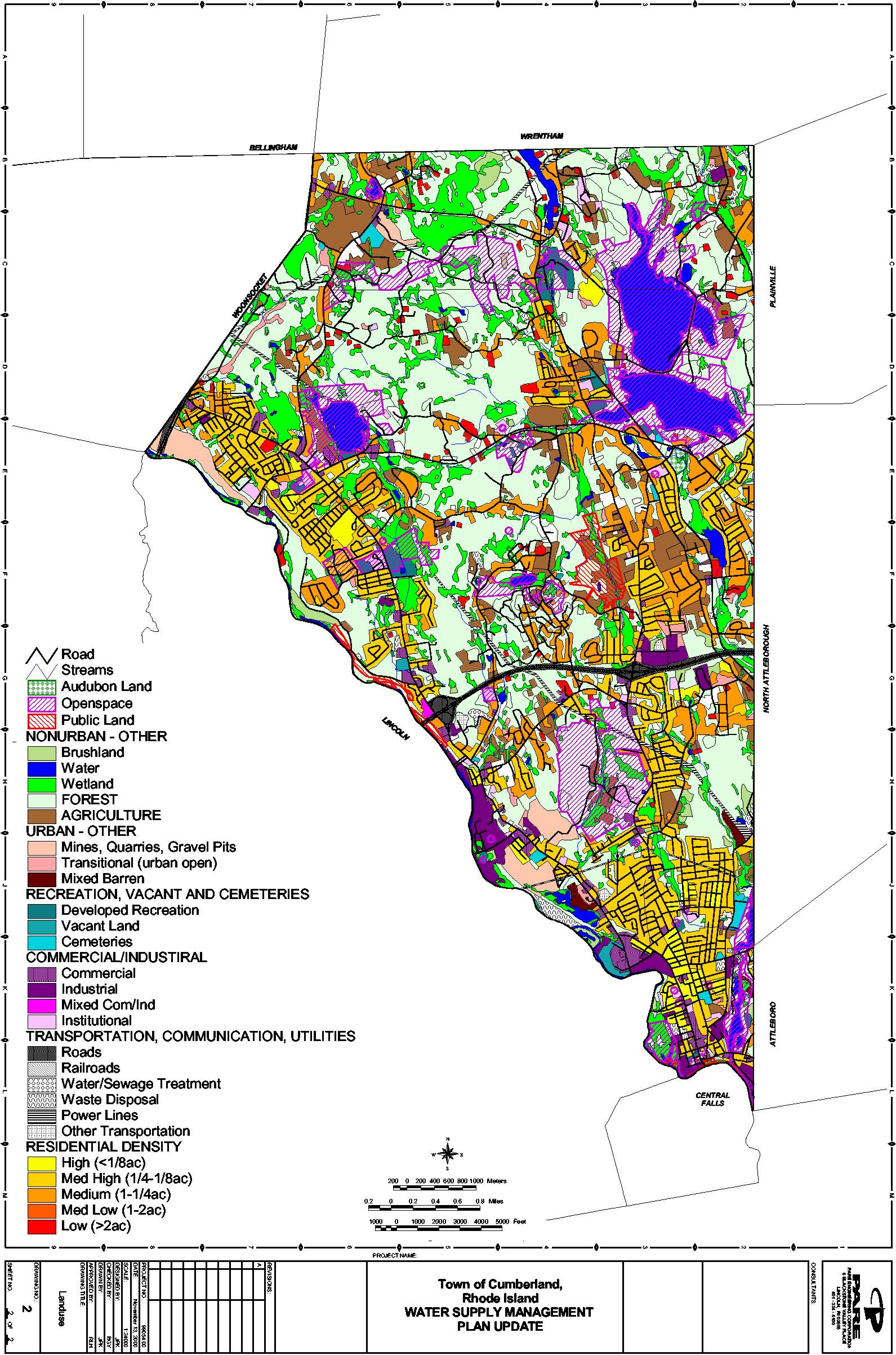
A Pare project that used GIS to map components of a Town’s water system.
As a recent graduate, Sarah hopes to stay ahead of the ever-evolving GIS technology and remain at the forefront of the field. GIS software is updated on a yearly basis, so this will be no easy feat, but she looks forward to making GIS her professional priority. Since I learned a bit about GIS, Sarah also shared her ideas of how the Marketing department may be able to benefit from data visualization in proposal making and through our web presence. I am looking forward to working together and exercising my newfound understanding of yet another really cool engineering tool. For more information on GIS, its capabilities, and how you can apply it to your work, visit the GIS resource website that one of Sarah’s college professors created.