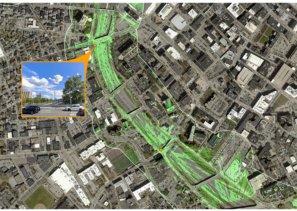
Pare Corporation, as a subconsultant to Jacobs Engineering Group, Inc., has provided ITS design, planning, and technical field support for the Rhode Island Department of Transportation’s centralized Transportation Management Center for many years. As part of RIDOT’s Statewide Transportation Improvement Plan (STIP), Pare conducted an assessment of proposed transportation projects across the state in proximity to existing and proposed ITS equipment.
RIDOT maintains a network of Traffic Cams throughout the state to provide real-time road and traffic conditions/advisories for travelers. Pare analyzed the visibility of existing CCTV infrastructure along several critical roadway corridors to evaluate viewshed conditions and the effectiveness of proposed camera pole placements throughout the state. Using LiDAR data, CCTV locations with height attributes, and geoprocessing tools available through ArcGIS Pro, Pare developed a dataset detailing the visibility of roadway corridors from existing and proposed camera locations to determine their range and identify gaps in coverage. The results of this analysis were published in interactive web maps on ArcGIS Online.